


Burke & McDowell Counties PUMA, North Carolina
About
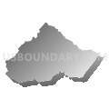
Outline

Summary
| Unique Area Identifier | 193641 |
| Name | Burke & McDowell Counties PUMA |
| State | North Carolina |
| Area (square miles) | 961.07 |
| Land Area (square miles) | 947.71 |
| Water Area (square miles) | 13.36 |
| % of Land Area | 98.61 |
| % of Water Area | 1.39 |
| Latitude of the Internal Point | 35.71606010 |
| Longtitude of the Internal Point | -81.86413490 |
Maps


Graphs
Select a template below for downloading or customizing gragh for Burke & McDowell Counties PUMA, North Carolina


Neighbors
Neighoring Public Use Microdata Area (by Name) Neighboring Public Use Microdata Area on the Map
- Boone High Country--Watauga, Ashe, Yancey, Avery & Mitchell Counties PUMA, NC
- Buncombe County (Northwest) PUMA, NC
- Buncombe County (Southeast)--Asheville City PUMA, NC
- Caldwell & Alexander Counties PUMA, NC
- Catawba County--Hickory City PUMA, NC
- Lincoln & Cleveland (East) Counties PUMA, NC
- Rutherford, Cleveland (West) & Polk Counties--Shelby City PUMA, NC
Top 10 Neighboring County (by Population) Neighboring County on the Map
- Buncombe County, NC (238,318)
- Catawba County, NC (154,358)
- Cleveland County, NC (98,078)
- Burke County, NC (90,912)
- Caldwell County, NC (83,029)
- Lincoln County, NC (78,265)
- Rutherford County, NC (67,810)
- McDowell County, NC (44,996)
- Yancey County, NC (17,818)
- Avery County, NC (17,797)
Top 10 Neighboring County Subdivision (by Population) Neighboring County Subdivision on the Map
- Cleveland, Cleveland County, NC (98,078)
- Hickory township, Catawba County, NC (61,829)
- Morganton township, Burke County, NC (28,058)
- Lenoir township, Caldwell County, NC (21,005)
- Marion township, McDowell County, NC (19,949)
- Lovelady township, Caldwell County, NC (18,000)
- Icard township, Burke County, NC (17,628)
- Black Mountain township, Buncombe County, NC (13,416)
- Silver Creek township, Burke County, NC (10,793)
- Lovelady township, Burke County, NC (8,546)
Top 10 Neighboring Place (by Population) Neighboring Place on the Map
- Hickory city, NC (40,010)
- Morganton city, NC (16,918)
- Marion city, NC (7,838)
- Long View town, NC (4,871)
- Valdese town, NC (4,490)
- Icard CDP, NC (2,664)
- Salem CDP, NC (2,218)
- Hildebran town, NC (2,023)
- Drexel town, NC (1,858)
- Connelly Springs town, NC (1,669)
Top 10 Neighboring Unified School District (by Population) Neighboring Unified School District on the Map
- Buncombe County Schools, NC (199,157)
- Catawba County Schools, NC (104,773)
- Cleveland County Schools, NC (98,078)
- Burke County Schools, NC (90,912)
- Caldwell County Schools, NC (83,029)
- Lincoln County Schools, NC (78,265)
- Rutherford County Schools, NC (67,810)
- McDowell County Schools, NC (44,996)
- Hickory City Schools, NC (31,410)
- Yancey County Schools, NC (17,818)
Top 10 Neighboring State Legislative District Lower Chamber (by Population) Neighboring State Legislative District Lower Chamber on the Map
- State House District 115, NC (79,480)
- State House District 97, NC (78,265)
- State House District 112, NC (75,804)
- State House District 110, NC (74,293)
- State House District 96, NC (72,247)
- State House District 85, NC (71,855)
- State House District 87, NC (68,349)
- State House District 88, NC (67,590)
- State House District 84, NC (65,274)
- State House District 86, NC (64,053)
Top 10 Neighboring State Legislative District Upper Chamber (by Population) Neighboring State Legislative District Upper Chamber on the Map
- State Senate District 41, NC (207,713)
- State Senate District 48, NC (193,127)
- State Senate District 42, NC (184,148)
- State Senate District 44, NC (173,941)
- State Senate District 49, NC (172,441)
- State Senate District 47, NC (168,288)
- State Senate District 46, NC (165,888)
Top 10 Neighboring 111th Congressional District (by Population) Neighboring 111th Congressional District on the Map
Top 10 Neighboring Census Tract (by Population) Neighboring Census Tract on the Map
- Census Tract 308, Caldwell County, NC (8,169)
- Census Tract 313, Caldwell County, NC (8,094)
- Census Tract 203.02, Burke County, NC (7,603)
- Census Tract 9709.01, McDowell County, NC (7,429)
- Census Tract 9602, Rutherford County, NC (6,973)
- Census Tract 209, Burke County, NC (6,929)
- Census Tract 211, Burke County, NC (6,431)
- Census Tract 106, Catawba County, NC (6,421)
- Census Tract 9601, Rutherford County, NC (6,265)
- Census Tract 118.01, Catawba County, NC (6,218)
Top 10 Neighboring 5-Digit ZIP Code Tabulation Area (by Population) Neighboring 5-Digit ZIP Code Tabulation Area on the Map
- 28655, NC (54,996)
- 28601, NC (50,026)
- 28645, NC (47,703)
- 28752, NC (30,600)
- 28602, NC (28,981)
- 28630, NC (20,041)
- 28714, NC (16,753)
- 28711, NC (13,209)
- 28612, NC (12,397)
- 28777, NC (10,638)